Property Record
56 Frontage Rd, West Amwell, NJ 08530

NEARBY LISTINGS FOR SALE OR LEASE
-
-
View all West Amwell listings for sale on LoopNet.com
Property Detail
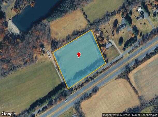
56 Frontage Rd
Newark, NJ-PA
Perryville Corporate Park Condominium
26-00007-0000-00016-02-Q0008
Hunterdon
Farms
New Jersey
X
16.2
34019C0345F
5.18 AC
2024
Hunterdon
2025
Northern New Jersey
010802
DEMOGRAPHICS near 56 Frontage Rd
1 Mile
3 Mile
5 Mile
2024 Total Population
337
4,367
20,399
2029 Population
338
4,377
20,452
Pop Growth 2024-2029
+ 0.30%
+ 0.23%
+ 0.26%
Average Age
44
46
47
2024 Total Households
125
1,706
8,657
HH Growth 2024-2029
0.00%
+ 0.29%
+ 0.38%
Median Household Inc
$122,368
$118,749
$130,316
Avg Household Size
2.70
2.60
2.30
2024 Avg HH Vehicles
2.00
2.00
2.00
Median Home Value
$625,000
$579,277
$590,923
Median Year Built
1963
1970
1971
Nearby Places
Map Layers
Map Styles
 Street
 Aerial
- Restaurants
- Banks
- Shops
- Fitness
- Groceries
PUBLIC TRANSPORTATION
AIRPORT
Trenton Mercer
DRIVE
WALK
Distance
Trenton Mercer
29 min
16.4 mi
Freight Ports
Port of Philadelphia
DRIVE
WALK
Distance
Port of Philadelphia
61 min
34.8 mi
Nearby Properties
Address
Land Use
TOTAL SIZE
Lot Size
Zoning
Address
Land Use
TOTAL SIZE
Lot Size
Zoning
53.62 AC
RR-5
Address
Land Use
TOTAL SIZE
Lot Size
Zoning
Address
Land Use
TOTAL SIZE
Lot Size
Zoning
31.35 AC
VAL
Address
Land Use
TOTAL SIZE
Lot Size
Zoning
11 AC
VAL
Address
Land Use
TOTAL SIZE
Lot Size
Zoning
1,536 SF
29.11 AC
LI
Address
Land Use
TOTAL SIZE
Lot Size
Zoning
540 SF
9.40 AC
LI
Address
Land Use
TOTAL SIZE
Lot Size
Zoning
4,200 SF
14.98 AC
HC
Address
Land Use
TOTAL SIZE
Lot Size
Zoning
105.42 AC
RR-5
Address
Land Use
TOTAL SIZE
Lot Size
Zoning
3,474 SF
4.09 AC
HC
Address
Land Use
TOTAL SIZE
Lot Size
Zoning
5,600 SF
10.99 AC
HC
Address
Land Use
TOTAL SIZE
Lot Size
Zoning
9,100 SF
5.40 AC
HC
Address
Land Use
TOTAL SIZE
Lot Size
Zoning
11,452 SF
3.95 AC
PRD
Address
Land Use
TOTAL SIZE
Lot Size
Zoning
12,978 SF
2.37 AC
A-1
Address
Land Use
TOTAL SIZE
Lot Size
Zoning
8,396 SF
2 AC
RR-5
Address
Land Use
TOTAL SIZE
Lot Size
Zoning
3 AC
LHC
Address
Land Use
TOTAL SIZE
Lot Size
Zoning
10,084 SF
2 AC
VAL
Address
Land Use
TOTAL SIZE
Lot Size
Zoning
20,316 SF
8.81 AC
HC
Address
Land Use
TOTAL SIZE
Lot Size
Zoning
89.44 AC
VAL
Address
Land Use
TOTAL SIZE
Lot Size
Zoning
11,594 SF
1 AC
VAL
Address
Land Use
TOTAL SIZE
Lot Size
Zoning
6.30 AC
HC
Address
Land Use
TOTAL SIZE
Lot Size
Zoning
Address
Land Use
TOTAL SIZE
Lot Size
Zoning
6,727 SF
19.86 AC
RR-5
Address
Land Use
TOTAL SIZE
Lot Size
Zoning
17,190 SF
6.79 AC
RR-5
Address
Land Use
TOTAL SIZE
Lot Size
Zoning
16,800 SF
1.60 AC
LB
Address
Land Use
TOTAL SIZE
Lot Size
Zoning
7,339 SF
4 AC
SRPD
Address
Land Use
TOTAL SIZE
Lot Size
Zoning
6,329 SF
7.70 AC
HO
Address
Land Use
TOTAL SIZE
Lot Size
Zoning
4,988 SF
1 AC
RR-5
Address
Land Use
TOTAL SIZE
Lot Size
Zoning
10,120 SF
1.80 AC
RR-5
Address
Land Use
TOTAL SIZE
Lot Size
Zoning
4,528 SF
2 AC
A-1
Address
Land Use
TOTAL SIZE
Lot Size
Zoning
8,035 SF
2.09 AC
PRD
The World's #1 Commercial Real Estate Marketplace
Connect with us
© 2025 CoStar Group
The information above has been obtained from sources believed reliable. While we do not doubt its accuracy we have not verified it and make no guarantee, warranty or representation about it. It is your responsibility to independently confirm its accuracy and completeness. Any projections, opinions, assumptions, or estimates used are for example only and do not represent the current or future performance of the property. The value of this transaction to you depends on tax and other factors which should be evaluated by your tax, financial, and legal advisors. You and your advisors should conduct a careful, independent investigation of the property to determine to your satisfaction the suitability of the property for your needs.